 ArcGIS Coordinate Systems Data
How to uninstall ArcGIS Coordinate Systems Data from your computer
This info is about ArcGIS Coordinate Systems Data for Windows. Here you can find details on how to uninstall it from your PC. It is developed by Environmental Systems Research Institute, Inc.. Additional info about Environmental Systems Research Institute, Inc. can be read here. More details about ArcGIS Coordinate Systems Data can be seen at http://www.esri.com. The application is often placed in the C:\Program Files (x86)\ArcGIS\CoordinateSystemsData folder (same installation drive as Windows). The full command line for removing ArcGIS Coordinate Systems Data is C:\Program Files (x86)\Common Files\ArcGIS\Support\ESRI.exe. Keep in mind that if you will type this command in Start / Run Note you may receive a notification for admin rights. ESRI.exe is the programs's main file and it takes about 210.43 KB (215480 bytes) on disk.ArcGIS Coordinate Systems Data installs the following the executables on your PC, taking about 210.43 KB (215480 bytes) on disk.
- ESRI.exe (210.43 KB)
The information on this page is only about version 10.6.8321 of ArcGIS Coordinate Systems Data. You can find here a few links to other ArcGIS Coordinate Systems Data versions:
...click to view all...
Quite a few files, folders and Windows registry data will not be removed when you are trying to remove ArcGIS Coordinate Systems Data from your PC.
Directories found on disk:
- C:\Program Files (x86)\ArcGIS\CoordinateSystemsData
The files below were left behind on your disk by ArcGIS Coordinate Systems Data's application uninstaller when you removed it:
- C:\Program Files (x86)\ArcGIS\CoordinateSystemsData\License\EULA.pdf
- C:\Program Files (x86)\ArcGIS\CoordinateSystemsData\pedata\geocon\gc_nad83_2007_2011_alaska_shifts.gcb
- C:\Program Files (x86)\ArcGIS\CoordinateSystemsData\pedata\geocon\gc_nad83_2007_2011_conus_shifts.gcb
- C:\Program Files (x86)\ArcGIS\CoordinateSystemsData\pedata\geocon\gc_nad83_2007_2011_prvi_shifts.gcb
- C:\Program Files (x86)\ArcGIS\CoordinateSystemsData\pedata\geocon\gc_nad83_harn_2007_alaska_shifts.gcb
- C:\Program Files (x86)\ArcGIS\CoordinateSystemsData\pedata\geocon\gc_nad83_harn_2007_conus_shifts.gcb
- C:\Program Files (x86)\ArcGIS\CoordinateSystemsData\pedata\geocon\gc_nad83_harn_2007_prvi_shifts.gcb
- C:\Program Files (x86)\ArcGIS\CoordinateSystemsData\pedata\ntv2\canada\Ntv2_0.gsb
- C:\Program Files (x86)\ArcGIS\CoordinateSystemsData\pedata\ntv2\spain\BALR2009.gsb
- C:\Program Files (x86)\ArcGIS\CoordinateSystemsData\pedata\ntv2\spain\PENR2009.gsb
- C:\Program Files (x86)\ArcGIS\CoordinateSystemsData\pedata\ntv2\switzerland\CHENYX06_etrs.gsb
- C:\Program Files (x86)\ArcGIS\CoordinateSystemsData\pedata\ntv2\uk\osgb36_xrail84.gsb
- C:\Program Files (x86)\ArcGIS\CoordinateSystemsData\pedata\ntv2\uk\OSTN15_NTv2.gsb
- C:\Program Files (x86)\ArcGIS\CoordinateSystemsData\pedata\vertical\egm\egm2008-1.grd
- C:\Program Files (x86)\ArcGIS\CoordinateSystemsData\pedata\vertical\egm\egm2008-25.grd
- C:\Program Files (x86)\ArcGIS\CoordinateSystemsData\pedata\vertical\egm\egm84.grd
- C:\Program Files (x86)\ArcGIS\CoordinateSystemsData\pedata\vertical\geoid\auckland_1946_to_nzgd2000.bin
- C:\Program Files (x86)\ArcGIS\CoordinateSystemsData\pedata\vertical\geoid\auckland_1946_to_nzvd2016.bin
- C:\Program Files (x86)\ArcGIS\CoordinateSystemsData\pedata\vertical\geoid\bluff_1955_to_nzgd2000.bin
- C:\Program Files (x86)\ArcGIS\CoordinateSystemsData\pedata\vertical\geoid\bluff_1955_to_nzvd2016.bin
- C:\Program Files (x86)\ArcGIS\CoordinateSystemsData\pedata\vertical\geoid\dunedin_1958_to_nzgd2000.bin
- C:\Program Files (x86)\ArcGIS\CoordinateSystemsData\pedata\vertical\geoid\dunedin_1958_to_nzvd2016.bin
- C:\Program Files (x86)\ArcGIS\CoordinateSystemsData\pedata\vertical\geoid\Dunedin-Bluff_1960_to_nzgd2000.bin
- C:\Program Files (x86)\ArcGIS\CoordinateSystemsData\pedata\vertical\geoid\Dunedin-Bluff_1960_to_nzvd2016.bin
- C:\Program Files (x86)\ArcGIS\CoordinateSystemsData\pedata\vertical\geoid\g2012ba0.bin
- C:\Program Files (x86)\ArcGIS\CoordinateSystemsData\pedata\vertical\geoid\g2012bg0.bin
- C:\Program Files (x86)\ArcGIS\CoordinateSystemsData\pedata\vertical\geoid\g2012bh0.bin
- C:\Program Files (x86)\ArcGIS\CoordinateSystemsData\pedata\vertical\geoid\g2012bp0.bin
- C:\Program Files (x86)\ArcGIS\CoordinateSystemsData\pedata\vertical\geoid\g2012bs0.bin
- C:\Program Files (x86)\ArcGIS\CoordinateSystemsData\pedata\vertical\geoid\g2012bu0.bin
- C:\Program Files (x86)\ArcGIS\CoordinateSystemsData\pedata\vertical\geoid\gisborne_1926_to_nzgd2000.bin
- C:\Program Files (x86)\ArcGIS\CoordinateSystemsData\pedata\vertical\geoid\gisborne_1926_to_nzvd2016.bin
- C:\Program Files (x86)\ArcGIS\CoordinateSystemsData\pedata\vertical\geoid\GSIGEOID2011.bin
- C:\Program Files (x86)\ArcGIS\CoordinateSystemsData\pedata\vertical\geoid\JGEOID2008.bin
- C:\Program Files (x86)\ArcGIS\CoordinateSystemsData\pedata\vertical\geoid\lyttelton_1937_to_nzgd2000.bin
- C:\Program Files (x86)\ArcGIS\CoordinateSystemsData\pedata\vertical\geoid\lyttelton_1937_to_nzvd2016.bin
- C:\Program Files (x86)\ArcGIS\CoordinateSystemsData\pedata\vertical\geoid\moturiki_1953_to_nzgd2000.bin
- C:\Program Files (x86)\ArcGIS\CoordinateSystemsData\pedata\vertical\geoid\moturiki_1953_to_nzvd2016.bin
- C:\Program Files (x86)\ArcGIS\CoordinateSystemsData\pedata\vertical\geoid\napier_1962_to_nzgd2000.bin
- C:\Program Files (x86)\ArcGIS\CoordinateSystemsData\pedata\vertical\geoid\napier_1962_to_nzvd2016.bin
- C:\Program Files (x86)\ArcGIS\CoordinateSystemsData\pedata\vertical\geoid\nelson_1955_to_nzgd2000.bin
- C:\Program Files (x86)\ArcGIS\CoordinateSystemsData\pedata\vertical\geoid\nelson_1955_to_nzvd2016.bin
- C:\Program Files (x86)\ArcGIS\CoordinateSystemsData\pedata\vertical\geoid\New_Zealand_Quasigeoid_2016.bin
- C:\Program Files (x86)\ArcGIS\CoordinateSystemsData\pedata\vertical\geoid\one_tree_point_1964_to_nzgd2000.bin
- C:\Program Files (x86)\ArcGIS\CoordinateSystemsData\pedata\vertical\geoid\one_tree_point_1964_to_nzvd2016.bin
- C:\Program Files (x86)\ArcGIS\CoordinateSystemsData\pedata\vertical\geoid\stewart_island_1977_to_nzgd2000.bin
- C:\Program Files (x86)\ArcGIS\CoordinateSystemsData\pedata\vertical\geoid\stewart_island_1977_to_nzvd2016.bin
- C:\Program Files (x86)\ArcGIS\CoordinateSystemsData\pedata\vertical\geoid\taranaki_1970_to_nzgd2000.bin
- C:\Program Files (x86)\ArcGIS\CoordinateSystemsData\pedata\vertical\geoid\taranaki_1970_to_nzvd2016.bin
- C:\Program Files (x86)\ArcGIS\CoordinateSystemsData\pedata\vertical\geoid\Thumbs.db
- C:\Program Files (x86)\ArcGIS\CoordinateSystemsData\pedata\vertical\geoid\wellington_1953_to_nzgd2000.bin
- C:\Program Files (x86)\ArcGIS\CoordinateSystemsData\pedata\vertical\geoid\wellington_1953_to_nzvd2016.bin
- C:\Program Files (x86)\ArcGIS\CoordinateSystemsData\pedata\vertical\vertcon\vertconc.94
- C:\Program Files (x86)\ArcGIS\CoordinateSystemsData\pedata\vertical\vertcon\vertcone.94
- C:\Program Files (x86)\ArcGIS\CoordinateSystemsData\pedata\vertical\vertcon\vertconecw.94
- C:\Program Files (x86)\ArcGIS\CoordinateSystemsData\pedata\vertical\vertcon\vertconw.94
- C:\Program Files (x86)\ArcGIS\CoordinateSystemsData\Setup.exe
- C:\Program Files (x86)\ArcGIS\CoordinateSystemsData\SetupFiles\Data1.cab
- C:\Program Files (x86)\ArcGIS\CoordinateSystemsData\SetupFiles\Documentation\EULA.pdf
- C:\Program Files (x86)\ArcGIS\CoordinateSystemsData\SetupFiles\Setup.ini
- C:\Program Files (x86)\ArcGIS\CoordinateSystemsData\SetupFiles\setup.msi
Generally the following registry keys will not be uninstalled:
- HKEY_LOCAL_MACHINE\SOFTWARE\Classes\Installer\Products\F16EB99D2CBEE2C4FA3D7743CBAF9B73
- HKEY_LOCAL_MACHINE\Software\Microsoft\Windows\CurrentVersion\Uninstall\ArcGIS Coordinate Systems Data
Use regedit.exe to remove the following additional values from the Windows Registry:
- HKEY_LOCAL_MACHINE\SOFTWARE\Classes\Installer\Products\F16EB99D2CBEE2C4FA3D7743CBAF9B73\ProductName
A way to remove ArcGIS Coordinate Systems Data from your PC with the help of Advanced Uninstaller PRO
ArcGIS Coordinate Systems Data is an application offered by Environmental Systems Research Institute, Inc.. Frequently, computer users decide to erase this program. This is hard because deleting this manually requires some know-how regarding Windows program uninstallation. The best EASY way to erase ArcGIS Coordinate Systems Data is to use Advanced Uninstaller PRO. Here are some detailed instructions about how to do this:1. If you don't have Advanced Uninstaller PRO on your system, add it. This is good because Advanced Uninstaller PRO is an efficient uninstaller and general utility to optimize your computer.
DOWNLOAD NOW
- visit Download Link
- download the setup by pressing the DOWNLOAD button
- install Advanced Uninstaller PRO
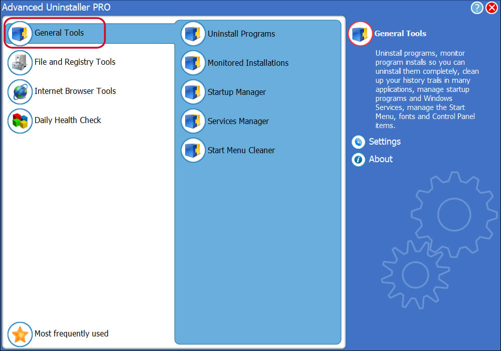
3. Press the General Tools category
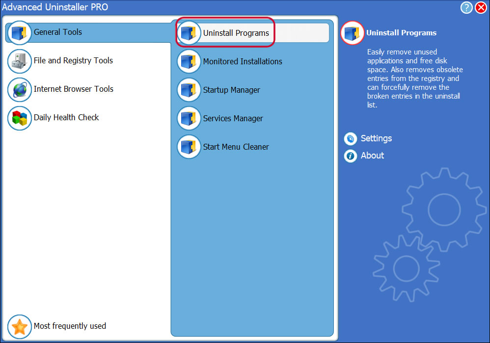
4. Press the Uninstall Programs tool
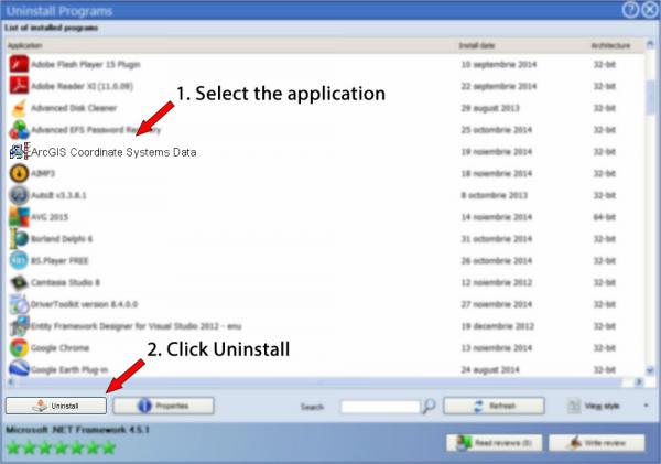
5. A list of the programs existing on the PC will appear
6. Scroll the list of programs until you locate ArcGIS Coordinate Systems Data or simply activate the Search field and type in "ArcGIS Coordinate Systems Data". The ArcGIS Coordinate Systems Data program will be found very quickly. Notice that when you select ArcGIS Coordinate Systems Data in the list , the following information about the program is made available to you:
- Star rating (in the left lower corner). This explains the opinion other people have about ArcGIS Coordinate Systems Data, ranging from "Highly recommended" to "Very dangerous".
- Reviews by other people - Press the Read reviews button.
- Technical information about the app you are about to uninstall, by pressing the Properties button.
- The publisher is: http://www.esri.com
- The uninstall string is: C:\Program Files (x86)\Common Files\ArcGIS\Support\ESRI.exe
8. After uninstalling ArcGIS Coordinate Systems Data, Advanced Uninstaller PRO will ask you to run a cleanup. Press Next to perform the cleanup. All the items of ArcGIS Coordinate Systems Data that have been left behind will be found and you will be able to delete them. By uninstalling ArcGIS Coordinate Systems Data using Advanced Uninstaller PRO, you are assured that no Windows registry entries, files or directories are left behind on your PC.
Your Windows system will remain clean, speedy and able to run without errors or problems.
Disclaimer
The text above is not a piece of advice to uninstall ArcGIS Coordinate Systems Data by Environmental Systems Research Institute, Inc. from your PC, we are not saying that ArcGIS Coordinate Systems Data by Environmental Systems Research Institute, Inc. is not a good software application. This page simply contains detailed instructions on how to uninstall ArcGIS Coordinate Systems Data supposing you want to. The information above contains registry and disk entries that Advanced Uninstaller PRO stumbled upon and classified as "leftovers" on other users' PCs.
2019-05-27 / Written by Daniel Statescu for Advanced Uninstaller PRO
follow @DanielStatescuLast update on: 2019-05-27 08:54:09.410